
Clearcutting tied to 18-fold increase in flood risk: UBC study
Study shows clearcut logging reshapes entire flood patterns with implications for B.C.’s forestry practices

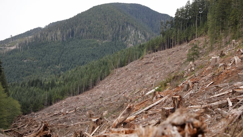
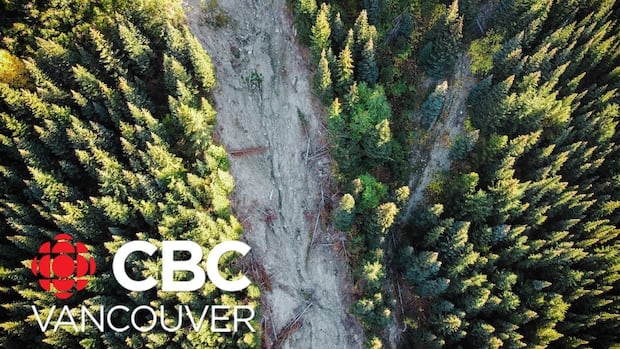
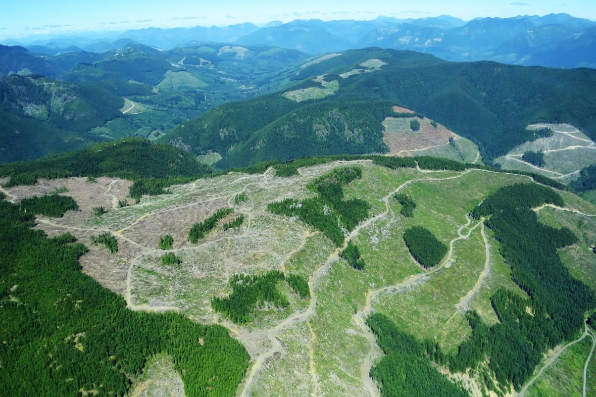
A new study from the University of British Columbia suggests that clearcut logging can make catastrophic floods up to 18 times more frequent.
The study, published in the Journal of Hydrology, analyzed long-term data from one of the world's longest-running forest research sites in North Carolina, the Coweeta Hydrologic Laboratory.
"We had a good opportunity to test out the effect of the physical characteristics of the landscape on the relationship between logging practices and flooding," Younes Alila, a UBC hydrologist and senior author of the study, told CBC News.
Researchers compared two neighbouring watersheds, one facing north, the other south, that were both clear-cut in the late 1950s. They found that clear-cutting in the north-facing watershed, which receives less sunlight and retains more moisture, had a dramatic effect on flood behaviour.
"The north-facing watershed was super sensitive," Alila said.
In that watershed, average flood sizes increased by nearly 50 per cent, while the largest floods were 105 per cent bigger than they were before logging.
"Different sides of the mountains will respond differently to logging," Alila explained.
He says the north side receives less sunlight, which keeps the soil wetter year-round. When storms arrive, the ground is already moist and can't absorb much water, causing more rain to run off into streams and rivers, resulting in larger floods.
In contrast, the south-facing watershed, which loses more moisture due to greater sunlight exposure, saw almost no change in flooding after clear-cutting.

Alila called the difference "a breakthrough finding," highlighting how landscape factors like the direction a slope faces can reshape a watershed's flood regime.
"The point we are trying to make is that we can use the way Mother Nature designed the landscape … to better manage the forest in ways that minimize the risk to hydrology and the risk of floods."
Precautionary approach
In addition to slope orientation, the hydrology professor emphasized that other landscape characteristics, including whether the terrain is flat or mountainous, contains lakes, wetlands or floodplains, all influence how a watershed responds to logging.
"You should not be logging in one part of a watershed without accounting for what's happening elsewhere in the same drainage basin," he said. "Water flows from highlands to lowlands so we need cumulative impact studies before moving ahead with forest development."
Alila says the current regulations in B.C. don't require companies to conduct proper watershed-level impact assessments before logging.
Researchers say the study's findings are directly relevant to the province, where clear-cut logging remains common and terrain features mirror those of the test site.
"Clear-cut logging in B.C. has increased the downstream flood risk rather dramatically," Alila added.
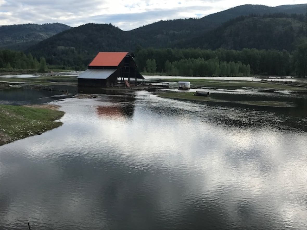
He points to the devastating 2018 floods in Grand Forks, B.C. as an example, saying clear-cutting in the Kettle River watershed played a major role.
Most flood models that predict the behaviour of floodwaters, assume a simple, predictable relationship between logging and flooding, the UBC professor says. For example, cutting down X per cent of trees, will likely result in Y per cent more water runoff.
But the study says after clear-cutting, the risk of extreme and unpredictable floods increases in ways that these basic models can't capture.
"This experimental evidence validates our longstanding call for better analysis methods," said Alila. "When we apply proper probabilistic tools to long-term data, we find much stronger and more variable impacts than older models suggest."
Jens Wieting, senior policy and science advisor with Sierra Club B.C., said the study underscores the need to reform forestry practices to respond to climate risks.
"This study is really demonstrating that we need a precautionary approach," said Wieting. "Clear-cutting can make climate change impacts worse."
He said moving away from clear-cutting and toward selective logging — a practice where only certain trees are harvested, leaving the rest of the forest intact — could help reduce flood risk, restore degraded landscapes, and save money in the long run by avoiding climate disaster costs.
Province acknowledges research
In a statement to CBC News, the B.C. Ministry of Forests said it "appreciates the research being done at UBC" and emphasized that the province continues to invest in water and forest management.
"Currently, through allowable cut determinations, the Chief Forester places limits on the rate of cut in each watershed to help provide balance to the many values our forested landscapes provide, including reducing flood risks," the statement reads.
The ministry says it's also moving beyond traditional modelling to better understand how changes to forests, water, and climate affect long-term sustainability. That includes promoting practices like selective thinning, fuel management and forest restoration.
The province has also introduced Forest Landscape Planning (FLP), which it describes as one of the most effective tools for reducing flood risk at a broader scale.
Still, Alila says implementation of old-growth deferrals and other reforms from the province have been slow.
"We continue old-growth logging…we've been aggressively clearcut logging for the last many decades so we only have a bit left."
ABOUT THE AUTHOR
