
UNB scientist checks in from first all-Canadian Antarctic mission
Researchers have spent weeks gathering data, collecting samples in the Drake Passage

A group of 15 researchers have been gathering data for the last two weeks as part of the first all-Canadian Antarctic mission.
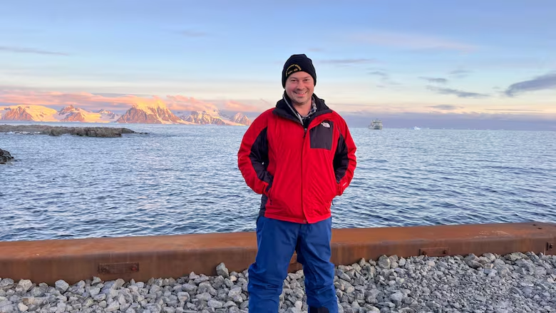
Kevin Wilcox, a research scientist with the University of New Brunswick's Ocean Mapping Group, is one of them.
"It's been a really amazing experience," Wilcox told CBC Radio's Information Morning Fredericton. "It's something that you can't really anticipate until you're here."
It's all part of Operation Projection, a Canadian naval mission.
The Canadian Navy's HMCS Margaret Brooke, an Arctic and offshore patrol vessel, is leading the mission through the icy landscapes of the Drake Passage to the South Shetland Islands, where researchers have been exploring coves and bays to perform scientific research.
After going through the Drake Passage, Wilcox arrived at Admiralty Bay and witnessed "breathtaking" tall sheets of ice. He also saw about 50 penguins swimming and jumping around the vessel.
"Everyone loves the penguins, and they have put on a fantastic show," he said.

Wilcox said he got to take part in the mission thanks to a combination of "hard work and luck."
He is a part of the Ocean Mapping Group at the University of New Brunswick, which has a small unmanned surface vessel for shallow-water coastal mapping. That's a capability the mission's ship doesn't have.
"That was really what helped secure the option for our group to bring that capability on board," said Wilcox.
He said that the unmanned vessel is about two metres in length and can see about 80 metres below the surface, making it capable of building a map of the ocean floor in great detail. That map is then used for charting or to help geologists understand what the sea floor is made of and what it looks like.
Wilcox said only about 25 per cent of the world's ocean floor is mapped.

"It's less than people think," he said. "There's been a lot of focus to try and increase that number in the last decade."
Wilcox said researchers on the mission are starting to wrap up their explorations after two weeks of going nonstop — "everything from me out on my small boat, to various coring and water sampling on the ship, and others going to shore."

The ship is now headed to the Antarctic Circle and the Rothera Research Station, "so things are starting to wind down on that science front, so now we're looking at the data we have, digesting that and starting that report-writing process."
Antarctica has long been a hotspot for exploration and critical for understanding the impacts of climate change.
"The rate of change at the poles is accelerating and is greater than other areas on the planet, so it's important to monitor these things, because we won't get the chance again," said Wilcox, "So there's a timeliness aspect as well."

Wilcox said each researcher on the mission is leading their own research with different approaches and focal points. But the variety of skills and outlooks have presented a unique opportunity for these researchers to collaborate.
"By having all of these different pieces, they combine to a larger story that any one of us would have a hard time to build on our own," he said.
While the mission at large has been a positive experience, researchers on board have shared concerns about what the future will hold for Antarctica in these unprecedented times, he said.
The "White Continent" is unique in that it's not owned by anyone, but rather has been governed by a treaty of 12 nations for 65 years.
Concern for the future of that treaty, which forbids military activity outside of assisting operations at research stations or scientific exploration, is rising with the current political climate in the United States.
"There's concern about more and more militarization, about the exportation of resources," he said, "Those are things where there are clear limitations in place by the treaty, but will those be respected going forward."
Corrections
- An earlier version of this story said the unmanned vessel of the Ocean Mapping Group could go 80 metres below the water. In fact, it is not an underwater vessel.Mar 17, 2025 3:48 PM EDT
ABOUT THE AUTHOR

With files from Information Morning Fredericton